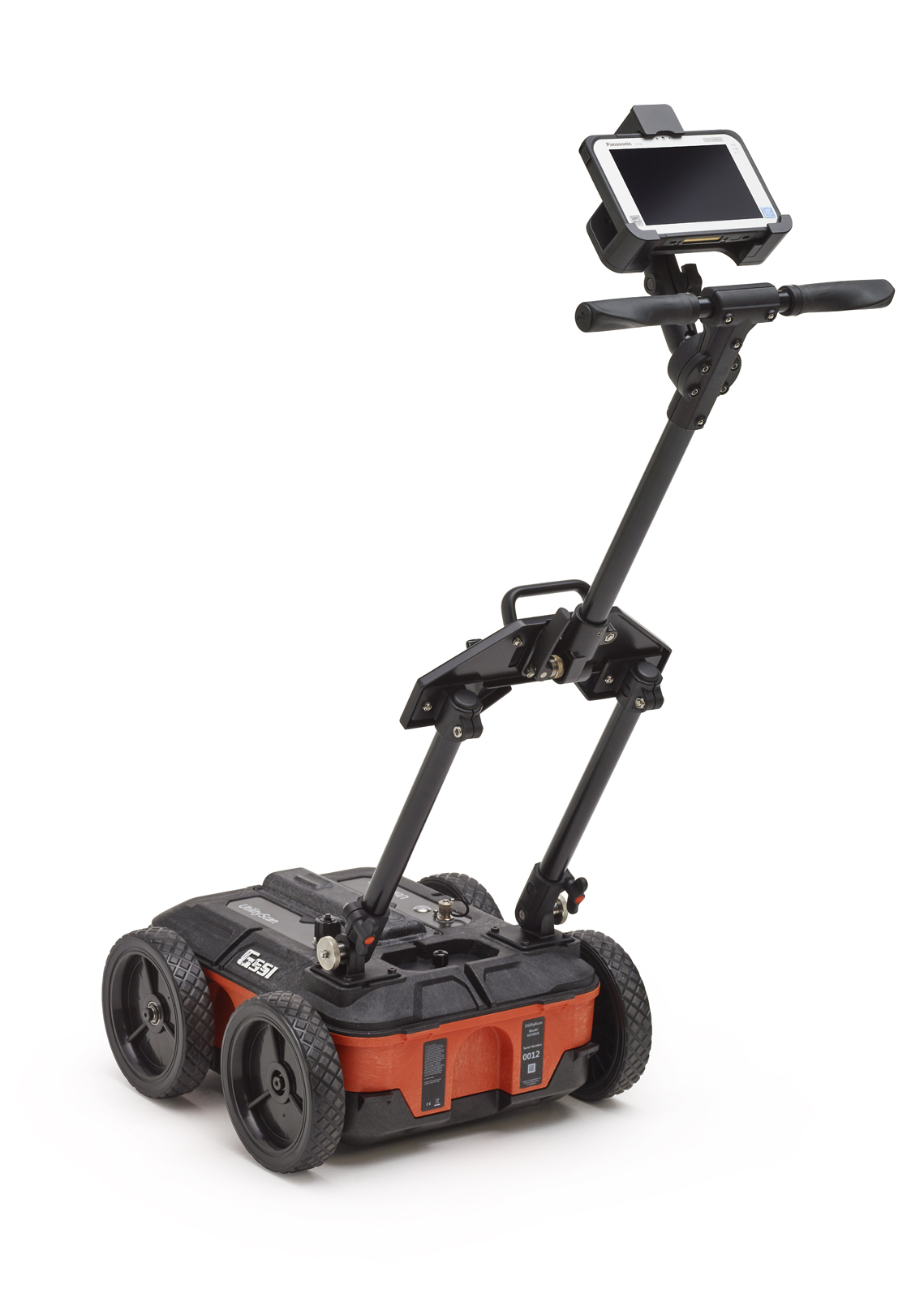
GSSI UtilityScan System
| Prep Fee | Daily | Weekly | Monthly |
|---|---|---|---|
| $ 150 | $ 175 | $ 790 | $ 2,755 |
Downloads
(4pg, 571KB)
UtilityScan® provides a rich feature set that redefines the level of performance available in a low cost utility locating system. The compact size makes it extremely portable and easy to maneuver in tight survey areas. The simple operation is ideally suited to meet the needs of service providers, engineering contractors and state and local municipalities. Best of all, the breakthrough technology designed into UtilityScan results in high quality data sets that are second to none.
Field Proven Performance:
- UtilityScan is based on GSSI’s patented HyperStacking™ technology, which provides excellent near-surface resolution and increased depth penetration in all soil types.
- A new wireless antenna eliminates the need for cabling resulting in a system that can withstand challenging field conditions
- The simplified app-based user interface ensures that UtilityScan is easy to use and quick to deploy
Advanced Capability:
- UtilityScan can be provided with the new LineTrac™ power detection module. This module is designed to identify and trace the precise location of underground electric and RF induced utilities
- UtilityScan uses enhanced software features for gain control, target detection and horizontal banding reduction.
Accurate, Easy and Lightweight
Enhanced User Experience
UtilityScan features an innovative touchscreen user interface. The app-based user interface provides two modes of operation: ScanEZ and ScanMax. The ScanEZ mode greatly simplifies operation for new users; ScanMax mode incorporates advanced features including GPS and LineTrac functionality.
Additionally, the system employs Dynamic Gain Control (DGC) which enhances ease of use by eliminating the need to repeatedly change gain settings when scanning areas with varying soil conditions. DGC monitors the system gain on the fly during data collection.
Positioning
An integrated GPS (global positioning system) is included with UtilityScan. For users requiring a higher resolution positioning system, a built-in pole mount is available for mounting GPS systems on survey poles. A Bluetooth interface is provided to facilitate communication with user-provided GPS systems.
Compact and Portable
The UtilityScan system is incredibly compact. Weighing in at only 34 pounds, UtilityScan can collapse to fit in the back of a small vehicle or even in an airline overhead compartment. For survey conditions in rough terrain, the user can remove the handle and wheels and place the capsule into the (optional) rugged cart.
HyperStacking™
HyperStacking provides superior near surface resolution, deeper depth penetration and vastly improved RF noise immunity when compared to traditional GPR antennas. HyperStacking (HS) is a patented real-time sampling technique that improves performance while maintaining measurement speed and minimizing radiated emissions. This technique uses multiple stacking (averaging) during data acquisition in order to reduce random noise and improve data quality
Dynamic Gain Control
The Dynamic Gain Control function recognizes a difference in subsurface conditions and automatically modifies the display gain. This eliminates the need for users to continually adjust the gain during surveys and provides a clearer, consistent data image.
LineTrac™
LineTrac is the first use of a power detection capability in a utility locating radar system. The most important requirements for utility locators are ease-of-use, accuracy and reliability. The key benefit is that detected power or induced frequencies can be overlaid on the radar data, providing reliable positioning and target information to the user. The combination of UtilityScan and LineTrac addresses these needs with features that deliver accurate, dependable and repeatable performance. These technologies are integrated into one seamless system to aid in target recognition and mapping for the first time.